
PrashantNews
Union Environment and Forest Minister Bhupender Yadav on Sunday said only 0.19% of the Aravalli range’s total area of 1.44 lakh square kilometers is eligible for mining and the rest of the Aravalli range is protected and preserved.
“Only 0.19% of the Aravalli range’s total area of 1.44 lakh square kilometers is eligible for mining. The rest of the Aravalli range is protected and preserved,” Yadav said on X.
Earlier experts have sought a clarification from the centre after it asserted that there is no imminent threat to the ecology of the Aravalli hills.
Experts said the government’s statement did not reflect how much area of the Aravalli range will be affected through the environment ministry’s new criterion. The save Aravalli campaign has already been launched in the country.
“Contrary to alarmist claims, there is no imminent threat to the Aravallis’ ecology. Ongoing afforestation, eco-sensitive zone notifications, and strict monitoring of mining and urban activities ensure that the Aravallis continue to serve as a natural heritage and ecological shield for the nation. India’s resolve is clear: the Aravallis will be safeguarded for present and future generations while balancing conservation with responsible development,” an official statement said.
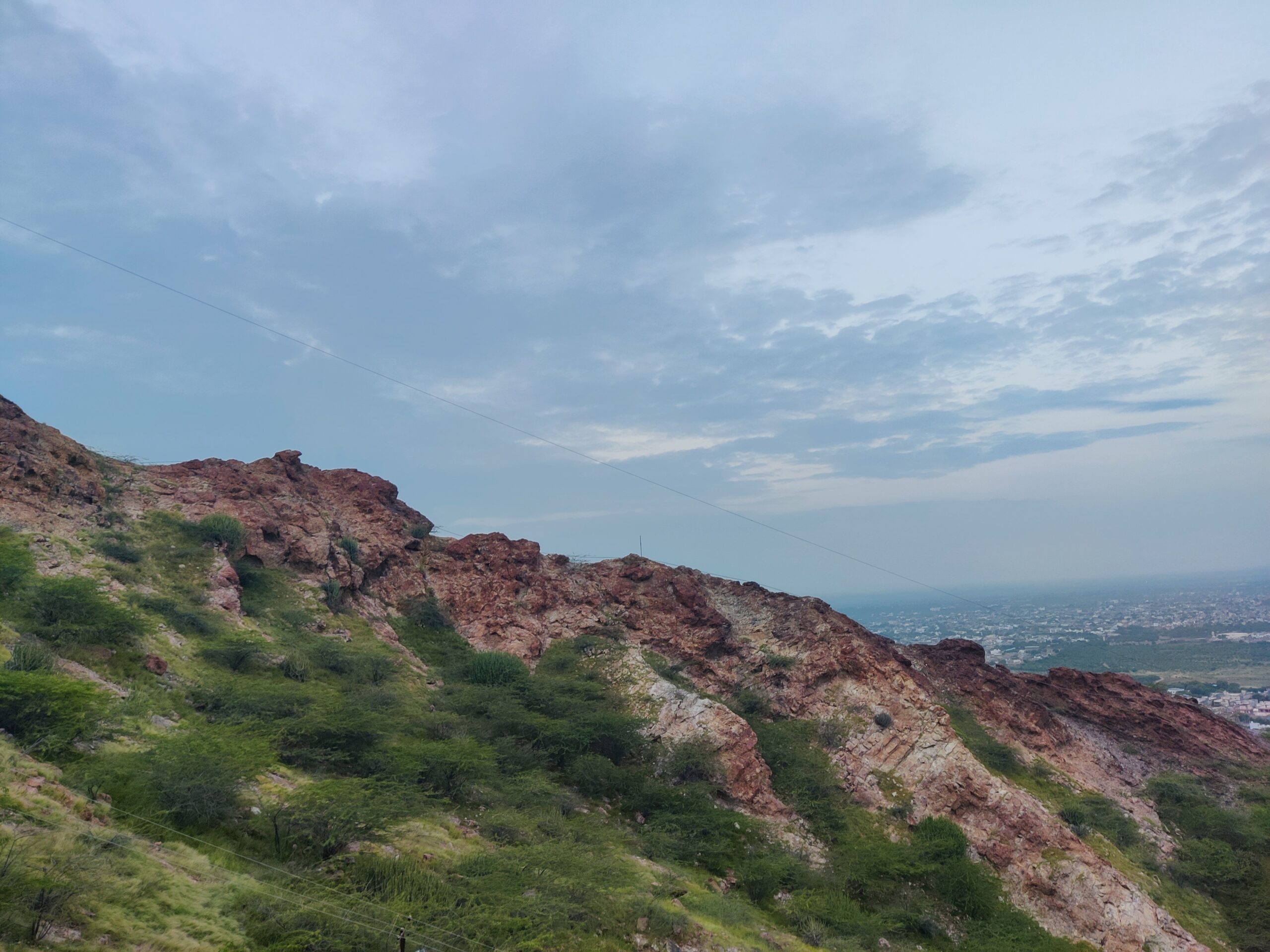
The Aravalli Hills, one of the world’s oldest mountain systems, has been trending on social media for the past few days after Supreme Court in its ruling on November 20 adopted the environment ministry’s criterion. The Centre’s criterion stated that only hills rising at least 100 metres above local relief, or clusters of such hills within 500 metres of each other, will now be recognised as part of the Aravalli range. This judgement by the apex court has sparked concerns among environmental activists and experts as they have warned that many parts of the ecologically vital Aravallis may no longer be protected and this could expose many regions, including Delhi, to harsher weather and drought conditions.
Spanning across approximately 670 km in length, the Aravalli mountain range has long served as a natural shield for blocking sand and dust from the Thar Desert. It also helps in groundwater recharge and sustaining rich biodiversity for multiple states, including the Delhi-NCR region.
After the Supreme Court accepted a new government definition that only hills taller than 100 meters will count, ‘SaveAravalli’ hashtag have flooded social media with experts and activists calling for protecting the Aravallis. As per the new definition, “Aravali Hill” is any landform in designated Aravali districts with an elevation of 100 metres or more above its local relief and an “Aravali Range” is a collection of two or more such hills within 500 metres of each other.
The government’s clarification so far:
- Transparent, Objective and Scientific: Aravalli Hills are defined as landforms rising 100 metres or more above local relief, including their supporting slopes. This prevents loopholes and ensures all genuine hill areas are covered.
- Ranges mapped comprehensively: Hills within 500 metres proximity are clustered into Aravalli Ranges, so intervening valleys, slopes, and smaller hillocks are also protected.
- Core/inviolate zones safeguarded: Mining is absolutely prohibited in protected areas, eco-sensitive zones, tiger reserves, wetlands, and CAMPA plantation sites.
- No new mining leases: The Supreme Court has ordered a freeze on new mining leases until a detailed sustainable mining plan (MPSM) is prepared.
- Strict regulation of existing mines: Current operations must comply with environmental clearance, forest clearance, and continuous monitoring; violations can lead to suspension.
- Illegal mining prevention: Surveillance with drones, CCTV, weighbridges, and district task forces ensures strong enforcement against unauthorized activity.
- Landscape-level planning: The upcoming MPSM to be prepared by ICFRE will identify permissible and prohibited zones, assess ecological carrying capacity, and mandate post-mining restoration.