
PrashantNews
The Dharali disaster has highlighted the high vulnerability of Himalayan settlements to disasters, the ISRO has said.
It said scientific analysis is being carried out to ascertain the cause of the triggering event.
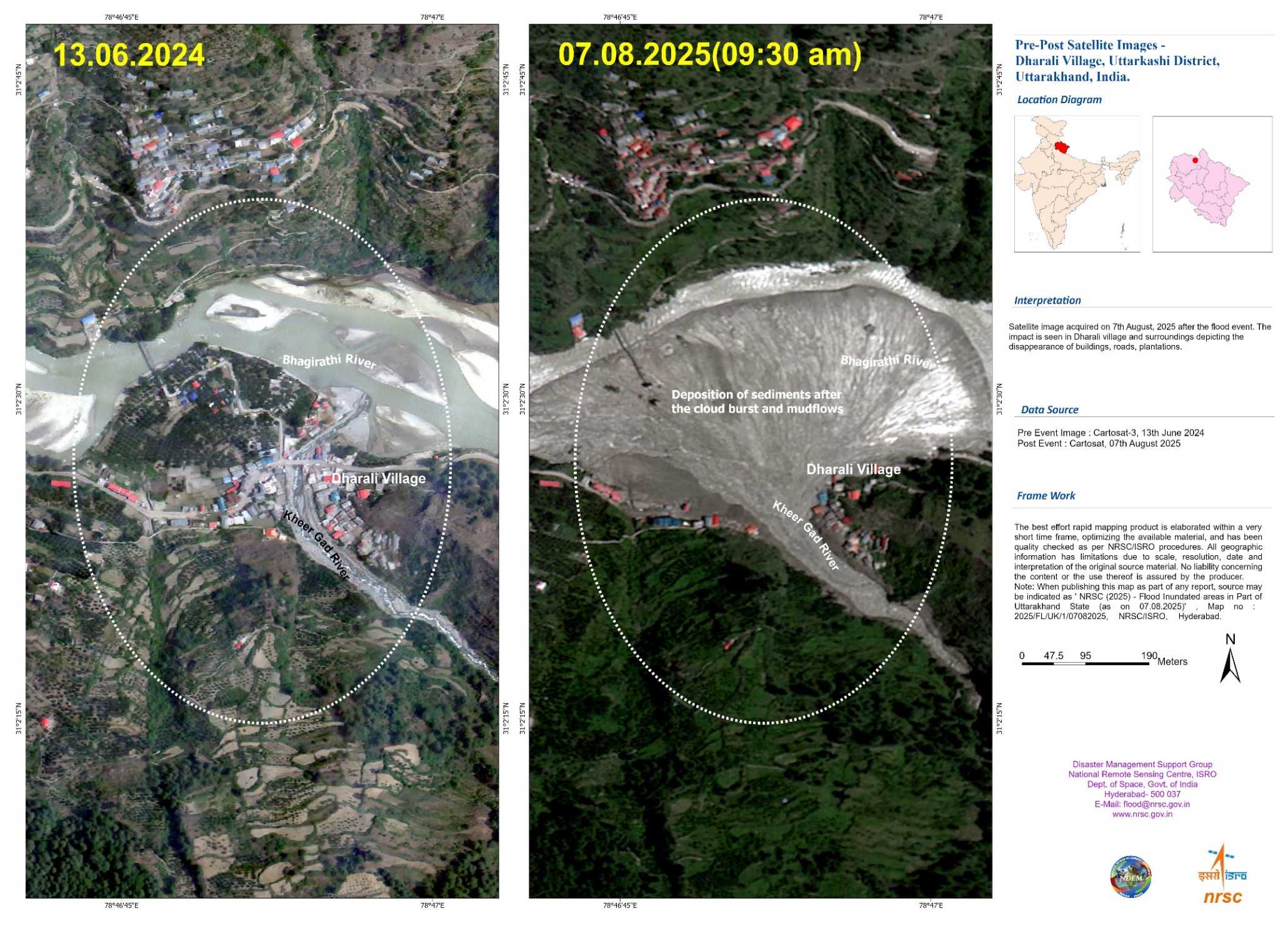
A flash flood triggered by intense rainfall caused debris-laden flows over Dharali and Harsil areas in Uttarkashi district, Uttarakhand, on August 5. The sudden deluge swept away homes, buildings, bridges, roads, and claimed unspecified casualties.
National Remote Sensing Centre (NRSC) / ISRO carried out rapid assessment of the damage using very high-resolution satellite images of India’s Cartosat-2S satellites. The comparative analysis of satellite images of 07.08.2025 (post-event) and available cloud-free pre-event data (13.06.2024) revealed the extent and severity of the destruction.
The salient findings include:
- Indications of flash flood, with widened stream channels, altered river morphology and damage to human lives & infrastructure.
- Fan-shaped deposit of sediment & debris at Dharali village (~20ha area, ~750m X ~450m), at the confluence of the Kheer Gad & Bhagirathi River.
- Partial / complete destruction and disappearance of several buildings in the flood-affected zone, likely submerged or swept away by the intense mud flow and debris.
- A number of buildings appear to be submerged with mud / debris, in Dharali village.