
PrashantNews
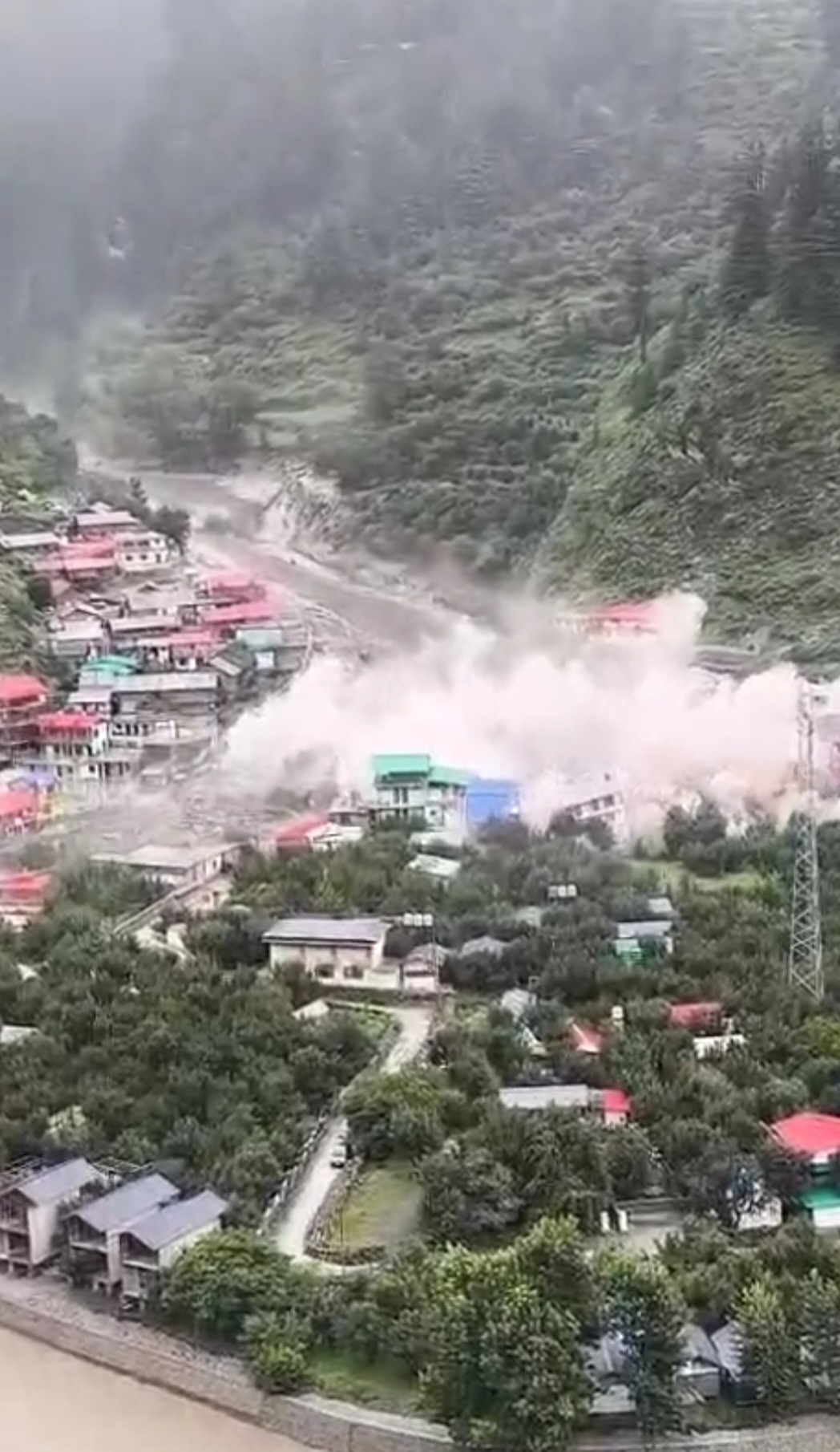
After a series of deadly disasters that struck Uttarakhand and some other parts of Himalayan region last year, the Ministry of Earth Sciences (MoES) on Wednesday said it has developed a comprehensive Multi-Hazard Early Warning System (MHEWS) to predict cyclones and heavy rainfall that cause mammoth flash floods and landslides.
The new system comprises observational networks, forecasting models, and an indigenously developed GIS-based Decision Support System (DSS), which serves as the front end for early warning systems to enable detection and monitoring of weather hazards, such as very heavy rainfall.
Giving this information, Union Minister of State (Independent Charge) for Earth Sciences and Science & Technology Dr. Jitendra Singh in Lok Sabha said the system is integrated with modern telecommunications technologies to ensure the timely dissemination of information.
The Central Water Commission (CWC) under the Ministry of Jal Shakti (MoJS) is mandated to issue short-range flood forecasts, with a lead time of up to 24 hours, to concerned state governments at identified locations, including the Himalayan States such as Uttarakhand.
Timely flood forecasts are being issued when a certain threshold limit is reached. Further, CWC is providing a seven-day advisory flood forecast through (https://ffs.india-water.gov.in/)/FloodWatch India 2.0 App/E-mail/Whatsapp/Facebook-CWCOfficial.FF/X-CWCOfficial_FF, Youtube-CWC Flood updates, and CAP Alert through the National Disaster Management Authority (NDMA) Sachet portal. In addition, a C-FLOOD is a web-based platform that provides two-day-advance inundation forecasts up to village level in the form of flood inundation maps and water level predictions. Also, the South Asia Flash Flood Guidance System provides flash flood warnings 6-24 hours in advance at the watershed level, with a resolution of 4km x 4km for flash flood-prone South Asian countries.
The Geological Survey of India (GSI), under the Ministry of Mines, has been mandated to issue regional landslide forecasts/early warnings based on rainfall thresholds. Currently, GSI issues daily operational/experimental regional landslide forecast bulletins for 21 districts in 08 (eight) States, including Uttarakhand, during the monsoon period. These bulletins forecast information on the possibility of the occurrence of landslides up to the taluk/sub-divisional level daily for the next 48 hours.
The meteorological infrastructure in Uttarakhand has been strengthened during the last three years with the following upgrades: A new X-Band Doppler Weather Radar (DWR) was installed and made operational at Lansdowne on 23 February 2024. With this addition, a total of three DWRs are now operational in the State, located at Surkanda, Mukteshwar, and Lansdowne.
Six (06) new Automatic Weather Stations (AWS) were installed in 2025, taking the total number of AWS in the State to 31.
The State is equipped with 20 Automatic Rain Gauges (ARGs) and 71 stations under the District-wise Rainfall Monitoring Scheme (DRMS).
Additionally, one Helipad Automated Weather Observing System (HAWOS) has been installed at Kedarnath to support weather monitoring in high-altitude regions.
The Government is using satellite-based remote sensing systems to monitor the melting and changes in the Himalayan glaciers.
The Indian Space Research Organisation (ISRO) employs advanced remote sensing and Geographic Information System (GIS) technologies to systematically monitor glacier extent, mass, movement, and dynamics in the Himalayan region. Satellite remote sensing serves as an effective tool for glacier inventory and monitoring due to its wide spatial coverage and frequent revisit capability. The assessment of long-term changes in glacial lakes is crucial for understanding glacier retreat, assessing the risks of Glacial Lake Outburst Floods (GLOFs), and analysing the impacts of climate change. Further, analysis of long-term satellite imagery covering the catchments of the Indian Himalayan river basins from 1984 to 2023 indicates notable changes in glacial lakes.
The Ministry of Earth Sciences, through its autonomous institute, the National Centre for Polar and Ocean Research (NCPOR), has been monitoring six glaciers in the Chandra basin (2437 km2) in the western Himalaya since 2013 using satellite remote sensing and field techniques. Further, several Indian institutes/universities/organizations funded by the Government of India through MoES, Department of Science & Technology (DST), Ministry of Environment, Forest and Climate Change (MoEFCC), Department of Space (DoS)-ISRO, Ministry of Mines (MoM), and Ministry of Jal Shakti (MoJS) monitor Himalayan glaciers for various scientific studies including glacier melting and have reported accelerated heterogeneous mass loss in Himalayan glaciers.
The India Meteorological Department (IMD), under the Ministry, provides a range of scientific, technical, and advisory support to States and other agencies for disaster preparedness. This support includes the following key areas:
IMD provides river sub-basin-wise Quantitative Precipitation Forecasts (QPFs) that are issued twice daily and are valid for the next seven days to the CWC.
IMD provides high-resolution forecasts of rainfall, temperature, humidity, wind, and extreme weather events, which are essential for watershed planning and water resource management.
Agrometeorological advisory services (AAS) are provided under the Gramin Krishi Mausam Sewa (GKMS), helping farmers and watershed planners adapt operations to changing climate conditions.
IMD issues alerts on cyclones, heavy rainfall, lightning, and droughts, enabling State disaster management authorities (SDMAs) to take timely action.
IMD publishes district-level climate hazard and vulnerability atlases (e.g., for heatwaves, droughts, and cyclones) that States use for planning resilient watershed development and prioritising risk mitigation.