 By Shishir Prashant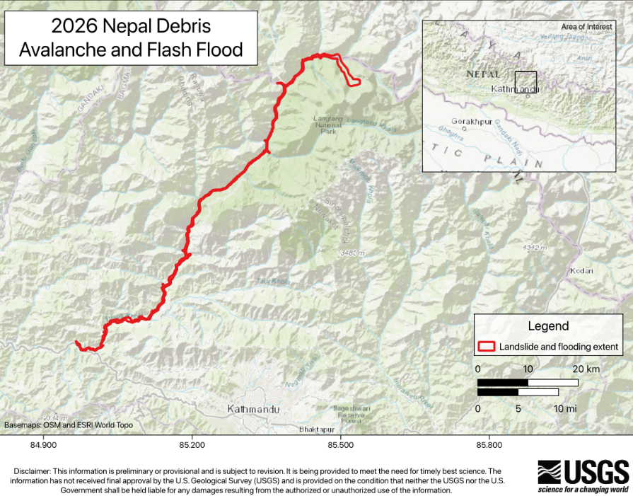
PrashantNews
The catastrophic floods that swept through parts of Nepal and reached China’s Gyirong Port might have been triggered by a glacial collapse generating an energy of 5.2 magnitude earthquake in Langtang National Park, a preliminary analysis by United States Geological Survey (USGS) has said.
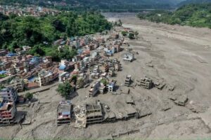
The calamitous floods laden with debris and boulders on August 26 left a big trail of death and destruction in Nepal and Tibet. The floods travelled nearly 100 km downstream through the Trishuli and Bhote Koshi river systems, causing extensive destruction to buildings and infrastructure, including a vital highway connecting Nepal and China.
According to the USGS, analysis of seismic waves generated by the event points to a source in a glaciated mountain cliff on the northern side of Langtang Lirung, a roughly 7,200-metre-high mountain and one of the world’s 100 tallest peaks.

The initial glacial collapse generated seismic energy equivalent to a magnitude 5.2 earthquake, while a second seismic event was recorded around three hours later, releasing energy equivalent to a magnitude 4.2 earthquake.
The USGS said the collapse involved a portion of the glacier breaking away and rapidly moving downslope. The mixture of ice, water and debris gathered additional rocks, boulders and water as it moved through existing stream and river channels, transforming into a fast-moving and long-travelling debris flow and flood.
USGS geologists are currently using satellite imagery to map the extent of the inundation. By comparing images captured before and after the disaster, scientists are identifying newly affected areas and tracing the boundaries of the debris flow and flood.
The disaster occurred in a geologically fragile region composed largely of high-grade metamorphic rocks, including gneisses, quartzites and marbles.
The USGS noted that the northern face of Langtang Lirung has witnessed a major disaster before. In 2015, a magnitude 7.8 earthquake triggered another massive debris avalanche from the mountain. Several million cubic metres of ice and debris collapsed from an elevation of about 5,000 metres and fell nearly 1,900 metres, burying a village and killing more than 200 people.
The latest assessment remains preliminary and could change as satellite imagery, seismic data and field observations are analysed further. The USGS said its immediate focus is on supporting response and recovery efforts through satellite-based hazard mapping.